
No matter where you go, there you are. Determining where “there” is, however, is another matter.
On Earth we can define our position by three parameters: latitude, longitude, and elevation. Latitude is the angular position that defines how far north or south you are from the equator. Elevation is your height above or below the average level of the oceans. Longitude is your angular position along the equator, relative to some point, which is now Greenwich, England. If you’re navigating at some point along the surface the world, latitude and longitude are the most important things to know.
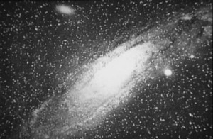
Latitude is fairly straightforward to determine. As the Earth rotates on its axis, the stars in the night sky appear to revolve around a fixed point in the sky, known as the celestial poles. In the northern hemisphere that point is fairly close (off by only 1°) to the second magnitude star Polaris, so by measuring the angle of Polaris relative to the horizon, you can get a good idea of your latitude. In the southern hemisphere there isn’t a bright star nearby, but you can use the Magellanic clouds to triangulate the south celestial pole.
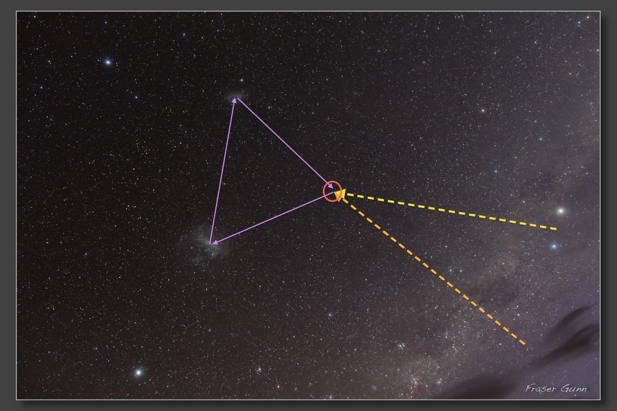
Finding the south celestial pole. Credit: Image still by Fraser Gunn, additions by Ethan Siegel.
While careful measurement of the stars can give a very accurate measure of latitude, it isn’t something easily done at sea. So instead, latitude was determined using a sextant to measure the angular position of the Sun at local noon, when it is highest in the sky. As long as it is a clear day, measuring the angle of the Sun is quite easy. The catch is that unlike the celestial poles, the angular height of the Sun at noon varies with the seasons. So you also need to know the date and have a table (or do the trigonometric calculation) that tells you the latitude at which the Sun would pass directly overhead that day. By taking this into account, you can then determine your latitude.
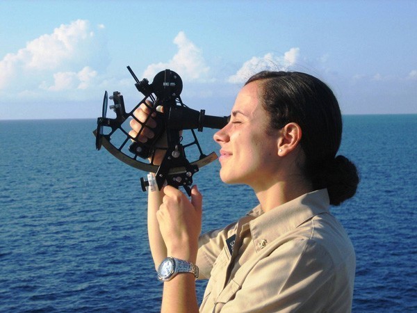
Even with modern GPS, sextants are used as a backup in naval navigation. Credit: NOAA
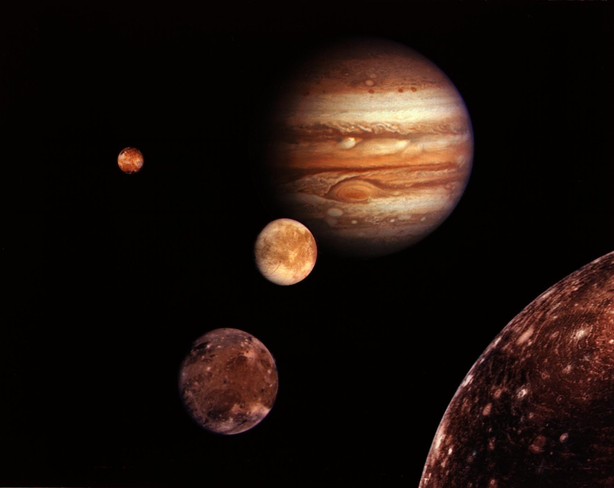
Longitude, however, is another matter. For one, unlike latitude it is reckoned relative to an arbitray point. We use Greenwich, England, but we could just as easily use Poughkeepsie, New York. For another, there is no simple way to use the Sun or stars to determine longitude. Given the importance of longitude, lots of methods have been proposed over the years, but until recently one of the more accurate methods was to use the moons of Jupiter.
When Galileo discovered four moons of Jupiter in the early 1600s, he noticed that their motions followed Kepler’s laws. This clockwork precision meant that the Jovian system could be used as a “heavenly clock” to determine the time. One way this could be done was by observing when the moons entered-or-exited the shadow of Jupiter as they passed behind the giant planet. Even with a small telescope, one could observe a moon fade to darkness over the course of a few minutes as it entered the shadow, or gradually brighten as it left the shadow on the other side.
With a table listing the predicted times of these eclipses as seen from a particular observatory, one could know the exact local time at that observatory. By comparing that with the time that you measured your local noon to be, you could then determine the time difference between your location and the observatory. Knowing that the Earth rotates 360 degrees in a day, you could then determine your longitude relative to the observatory.
Galileo went so far as to calculate time tables for these eclipses, but they weren’t accurate enough to be very useful. Then in 1668 Giovanni Domenico Cassini published the first truly accurate table of Galilean eclipses. Cassini’s tables were so accurate that they redefined the shape of Europe. The distances between cities as given since the Roman Empire were found to be hundreds of kilometers off. You can see this in the maps of Europe before and after Cassini’s tables.
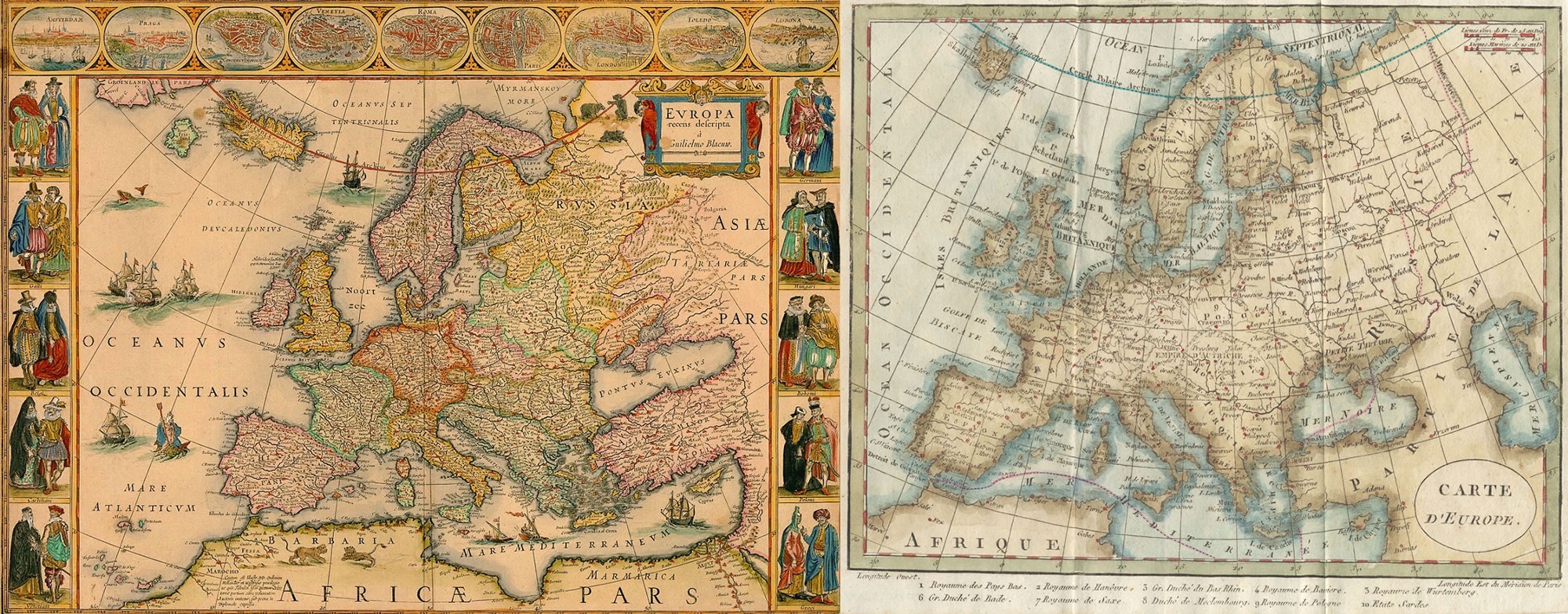
Left: Willem Bleu’s 1650 map of Europe. Right: Robert Janvier’s 1764 map of Europe.
Despite its accuracy, the Galilean method of longitude had some serious drawbacks. There are times when Jupiter is too close to the Sun for the moons to be observed, and the method was completely useless while at sea. By the late 1700s John Harrison’s marine chronometer became the preferred method for calculating longitude at sea, but well into the 1800s Galileo’s method was preferred for land explorers. Chronometers were both expensive and fragile, so a small telescope was the preferred tool.
Modern methods have now replaced Galileo’s moons as a method of calculating longitude, but the moons of Jupiter were a huge step forward that quite literally changed the face of the world.


Comments
I like that you used a picture of Fraser Gunn for showing the southern celestial pole. I have seen and talked to him a few times at the observatory in Tekapo where he served cafe & cake in the cafe on top of Mt John, right next to the observatory. This is a few years back though. He seemed to be a real down to earth bloke.